
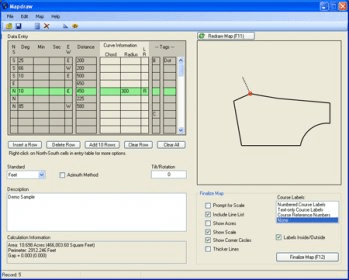
DeedMapper is a software program designed for historical research. It is capable of handling surveys with straight lines, even when the deed descriptions are incomplete or have obscure compass directions such as "north by west 1/4 point west". It can also handle meander lines along a creek, old oak trees, and piles of stones that mark property corners. It supports multiple measurement units and survey methods, and even allows for parcels to be rotated to compensate for magnetic compass.
DeedMapper is designed for historical research so it handles surveys that have straight lines.
And those old deeds can have incomplete direction and distance information, obscure compass rose directions such as north by west 1/4 point west, and meander lines along a creek. Not to mention those old oak trees and piles of stones that mark the property corners.
These are no problem for DeedMapper! Many different measurement units and survey methods are supported. Partial plots are created when deed descriptions are incomplete. And parcels can even be rotated to compensate for magnetic compass errors.




Comments